eyeonlakeo.com
Live and Historical Data
Live data feeds from South Florida Water Management District, Army Corps of Engineers and Florida Dept. of Environmental Protection
Big O Chart
and Number Cruncher
Ecological Envelope vs. Current Lake Stage RECOVER and SFWMD Position Analysis
All Active Salinity Stations in DBHydro (Top and Bottom)
Salinity Averages St. Lucie River
Lake and C-44 Basin Discharges 1952-current
C44 Reservoir Inflows
STA Outflows
and Reservoir Storage
Daily Status Map ACOE
Lake O Daily Outlook Plot
(ACOE)
Lake O Interactive Daily Hydrograph (SFWMD)
St Lucie @ C23 C24 C25 Interactive Daily Hydrograph (SFWMD)
Roosevelt Bridge Salinity
S-308 Graph (Port Mayaca)
S-80 Graph (Spillway at St. Lucie Locks)
STA Reports
SFWMD
SFWMD Live Lake O Inflows and Outflows
SFWMD LIve S-80 Details
Roosevelt Bridge Tide Graph
Backpumping 1-year Graph (S-2 Near Belle Glade, S-3 Lake Harbor & S-4 Near Clewiston)
Historical Flows By Site DBKey
Cumulative Dischrge Totals, S-80, S-308, S-79 and S-77 with conversions
2013 (The "Lost Summer) vs 2023
Lake Level on June 1
vs.
Lake Discharges to Estuaries from June 1 - Dec 31
Next:
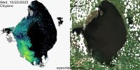
NCCOS HAB Images